
What Is a Hazard Severity Zone? A Homeowner's Guide
Find out what a hazard severity zone means for your California home, how to check your zone, and steps you can take to reduce wildfire risk.

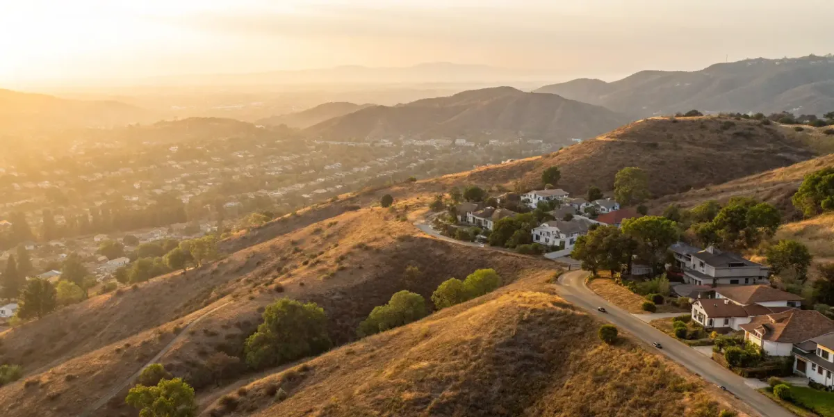
Discovering your home is in a high-risk fire area can feel overwhelming. But that label isn't your destiny. Instead of a scary warning, think of your hazard severity zone designation as a powerful tool. It gives you the specific information you need to protect your family and your biggest investment. We’ll break down exactly what it means to live in one of these areas. More importantly, we’ll give you a clear, manageable action plan for reducing your risk and gaining true peace of mind. This is your guide to taking control.
Key Takeaways
- Focus on Risk, Not Just Your Zone: Your official Fire Hazard Severity Zone is based on long-term landscape factors you can't change, but your home's immediate risk is determined by actions you can control, like creating defensible space.
- A High-Risk Zone Involves Legal Duties: Living in a High or Very High zone comes with specific responsibilities, including maintaining defensible space, following fire-safe building codes, and disclosing the zone status when you sell your home.
- Proactive Safety Can Improve Insurance Options: Your zone designation isn't the only factor in securing insurance. By actively reducing your property's risk through home hardening and fuel reduction, you can make your home more attractive to insurance carriers.
What Is a California Fire Hazard Severity Zone?
If you’re a homeowner in California, you’ve likely heard the term "Fire Hazard Severity Zone," or FHSZ. It sounds intimidating, but it’s simply a way the state classifies land based on wildfire potential. Think of it as a rating system designed to help communities understand and prepare for wildfire. Under state law, CAL FIRE is responsible for identifying these areas to help local governments create safety plans and building codes that save lives and homes. Understanding your zone is the first step in protecting your property and making informed decisions about your insurance.
The 3 Official Fire Zone Classifications
So, what do the different zones mean? State law establishes three levels of fire hazard: Moderate, High, and Very High. These classifications are based on factors that contribute to the likelihood and behavior of a wildfire, such as vegetation, topography, and weather patterns over a 30- to 50-year period. The official FHSZ maps show how these zones are distributed across the state. A "Very High" zone, for example, has the optimal conditions for a fire to start and spread, while a "Moderate" zone has a lower potential. It’s a scientific assessment of the landscape’s natural tendency to burn.
Why Your Fire Zone Designation Matters
Knowing your zone helps you understand the potential wildfire behavior in your area. These ratings aren't just abstract labels; they indicate how likely and intense a wildfire could be if one were to start. It’s important to remember that the zone designation reflects the hazard—the physical conditions of the landscape—not necessarily the immediate risk to your specific home. However, if your property is located within or near a High or Very High zone, it naturally faces a greater threat from wildfire. This information is crucial for local planning, emergency response, and for you as a homeowner when creating a wildfire preparedness plan.
Fire Hazard vs. Fire Risk: What's the Difference?
It’s easy to use "hazard" and "risk" interchangeably, but in the world of wildfire and insurance, they mean very different things. A hazard refers to the natural conditions that contribute to wildfire over a long period, like fuel and terrain, without considering any protective measures. You can't change your hazard zone. Risk, on the other hand, is the potential for damage to your property right now. The good news is that you have control over your risk. By taking steps like creating defensible space, hardening your home with fire-resistant materials, and having a solid evacuation plan, you can significantly lower your risk, even if you live in a Very High Fire Hazard Severity Zone.
Understanding Pre-Fire Hazard vs. Post-Fire Severity
It’s easy to see a term like "Very High Fire Hazard Severity Zone" and feel a sense of dread. But let's separate the landscape from your home. The official zone rating, or "pre-fire hazard," is a broad assessment of the surrounding environment's potential to fuel a wildfire over a long period—think 30 to 50 years. CAL FIRE develops these Fire Hazard Severity Zone maps using a scientific model that scores factors you can’t control, like regional weather patterns, topography, and the type of native vegetation. It’s a high-level look at the ingredients for wildfire that are naturally present in your area.
The "post-fire severity," or the actual damage a fire could do to your specific property, is a different story—and it’s one you can help write. This is your home's immediate "risk," and it’s determined by the proactive measures you take. While you can't flatten a nearby hill or stop the Santa Ana winds, you can create defensible space, install fire-resistant siding, and clear your gutters. Understanding this distinction is incredibly empowering. It means your zone designation isn't your destiny. By focusing on managing your home's risk, you can dramatically improve its resilience and make it a much more attractive property to insure, even in a high-hazard area.
Common Myths About Fire Zone Maps, Debunked
One of the biggest misconceptions is that your FHSZ designation directly determines your insurance premium. While it might seem logical, CAL FIRE’s official maps are not designed to set insurance rates or availability. Insurers use their own complex models to assess a property’s specific risk, looking at everything from roof materials and surrounding vegetation to local fire department response times. The FHSZ map might be one of many data points they consider, but it’s not the final word. Your home’s individual characteristics and the mitigation steps you’ve taken often play a much larger role in how an insurance carrier views your property.
How Are Fire Hazard Severity Zones Mapped?
It can feel a little arbitrary to see your home placed in a high-risk zone, but there’s a lot of careful science behind how those lines are drawn. California’s Fire Hazard Severity Zone (FHSZ) maps aren’t just suggestions; they’re official tools created under state law to help communities understand and reduce their wildfire risk. Think of them as a roadmap for safety, guiding everything from building codes to insurance requirements.
These maps are built using sophisticated modeling that predicts how a fire is likely to start and spread in a specific area. It’s a complex process that combines decades of data with on-the-ground realities. Understanding what goes into your zone’s designation is the first step in learning how to protect your home and family.
The Origins of FHSZ Mapping
So, where do these zone designations actually come from? They aren’t drawn up on a whim. CAL FIRE develops these maps using a meticulous, science-based model that’s been tested in the field. This process evaluates the core factors that influence how a wildfire is likely to behave, like the type of vegetation in an area, the steepness of the hillsides, and typical weather patterns over a 30- to 50-year timeframe. The goal is to create a reliable picture of a landscape's natural tendency to burn, providing a solid foundation for local governments to create safety plans that can protect lives and property. By understanding the science, you can better appreciate how these maps serve as a critical tool for community-wide wildfire preparedness.
What Factors Determine a Fire Zone?
The creation of Fire Hazard Severity Zone maps is a formal process managed by CAL FIRE’s Office of the State Fire Marshal (OSFM). State law requires these maps to be scientifically based, ensuring they accurately reflect the real-world threat of wildfire. The goal is to provide a consistent, statewide picture of fire hazard that local governments and residents can use for community wildfire preparedness. The models analyze dozens of factors to determine not just the likelihood of a fire, but its potential intensity and behavior if one were to occur.
Modeling Flame Length and Ember Spread
To predict how a fire might behave, the models focus on two key threats: flame length and ember spread. Flame length is exactly what it sounds like—a prediction of how high the flames could get based on fuel, slope, and weather. Taller flames mean more intense heat, making a fire much harder to fight and a greater danger to your home. But the threat doesn't stop at the fire's edge. The models also calculate the spread of blowing embers, which are tiny bits of burning debris that wind can carry for more than a mile. These embers are a leading cause of homes catching fire during a wildfire. By analyzing the shape of the land and common weather patterns, CAL FIRE can map out the true danger zone of a potential fire.
How Landscape and Weather Influence Your Zone
Your local environment plays a huge role in determining your zone. The mapping process looks closely at factors that influence fire behavior. This includes the type and density of vegetation (which acts as fuel), the steepness of slopes (fire travels uphill much faster), and typical weather patterns like strong winds and low humidity. The models even calculate how far burning embers could travel during a wind-driven fire, which is often how flames jump from wildlands into neighborhoods. All these elements are combined to create a comprehensive picture of your area’s unique fire hazard.
Does Fire History Affect Current Maps?
One of the most reliable predictors of future fires is past fire activity. The mapping process includes a deep dive into the fire history of a region. Analysts look at where fires have occurred before, how large they grew, and how they behaved. This historical data provides critical insight into how the landscape responds to fire under different conditions. If your area has a history of frequent or intense wildfires, it’s more likely to be designated as a Very High Fire Hazard Severity Zone, reflecting that proven pattern of risk.
Why Do Fire Zone Maps Get Updated?
Fire hazard isn’t static, and neither are the maps. These zones are updated every few years to reflect changes on the ground. A new housing development, a shift in vegetation after a drought, or a recent wildfire can all alter an area’s hazard level. These regular updates ensure the maps remain an accurate and relevant tool for homeowners, firefighters, and city planners. While it can be frustrating to see your zone change, it’s a sign that the system is working to keep up with the evolving landscape and provide the most current safety information possible.
The 2024 Map Updates for State Responsibility Areas
This year, CAL FIRE finalized its updated maps for State Responsibility Areas (SRAs), which officially went into effect on April 1, 2024. These aren't just lines on a map; they're the result of a deep scientific dive into California's landscape. To determine the zones, CAL FIRE’s model analyzes factors like vegetation, terrain, and typical fire weather to predict how a wildfire might behave over a 30- to 50-year period. This long-term view helps ensure the maps reflect the natural fire hazard of an area, giving communities a reliable tool for wildfire preparedness and planning.
For you as a homeowner, these updates provide a clearer picture of the landscape's potential for fire, helping you make smarter decisions about safety. The maps are designed to help local governments create effective safety standards and building codes, which you can see in action on sites like Placer County's FHSZ resource page. Ultimately, knowing your zone isn't about feeling stuck; it’s about being informed. It highlights exactly where you should focus your efforts, reinforcing the importance of maintaining defensible space and using fire-safe building materials to reduce your home’s specific risk.
Living in a High-Risk Fire Zone: What You Need to Know
Discovering your home is in a high or very high-risk fire zone can feel overwhelming, but it’s really the first step toward empowerment. This designation isn’t just a label on a map; it’s a call to action that comes with a clear set of responsibilities and resources designed to protect your family and property. Living in these areas means adopting a proactive mindset about wildfire safety.
From maintaining your property and choosing building materials to understanding your insurance options and legal duties, your zone designation influences several key aspects of homeownership. Think of it as a roadmap. The state provides the map by identifying the hazard level, and in return, homeowners, local agencies, and fire departments work together to reduce the risk. Understanding your role in this partnership is essential for building a more resilient community and securing your peace of mind.
Your Guide to Defensible Space Laws
If you live in a high-risk zone, the term “defensible space” is one you need to know. It’s the buffer you create between your home and the surrounding grass, trees, and shrubs. This isn’t just a friendly suggestion—it’s often a legal requirement. The goal is to create a zone around your home where firefighters can safely do their jobs and to slow or stop the spread of a wildfire before it reaches your doorstep.
Properly managed defensible space is crucial for your home’s survival. It involves strategic spacing and maintenance of vegetation to reduce flammable fuel. You can learn exactly how to create defensible space by following guidelines that break down your property into zones, helping you make smart choices about landscaping and clearing.
The 100-Foot Rule for Very High FHSZ
For those in a Very High FHSZ, the guidelines are even more defined. If your home is in one of these zones, you must follow strict rules to create and maintain 100 feet of defensible space around all structures. This doesn't mean you need a barren dirt circle around your house. Instead, it’s about creating a well-managed landscape that reduces flammable materials that act as fuel for a fire. The goal is to build a buffer that can slow an approaching wildfire, giving firefighters a safer area to work and increasing the chances that your home will survive. Adhering to this 100-foot rule is a legal responsibility and one of the most powerful actions you can take to lower your property's specific risk.
How Your Fire Zone Affects Your Home Insurance
Your home’s location in a High or Very High Fire Hazard Severity Zone is one of the biggest factors influencing your insurance options. Many carriers have become more cautious about offering coverage in these areas, which can lead to higher premiums or even non-renewals. It’s a frustrating reality for many California homeowners, but it doesn’t mean you’re out of options.
Taking proactive steps to mitigate your risk can significantly improve your insurability. Insurers look favorably on homeowners who have created defensible space, installed ember-resistant vents, and used fire-resistant materials for roofing and siding. These actions demonstrate that you’re serious about protecting your property, which can make all the difference when seeking coverage. Understanding how fire hazard severity zones affect your policy is the first step to finding a solution.
The Official Stance from the California Department of Insurance
It’s easy to assume that a high-risk zone designation on a map automatically translates to sky-high insurance premiums or a non-renewal notice. But what does the state’s top insurance regulator have to say? The California Department of Insurance is clear on this point: CAL FIRE's Fire Hazard Severity Zone maps are not designed to directly set your insurance rates or determine whether you can get coverage. While your zone is certainly a significant piece of the puzzle, it’s not the whole story. Insurance carriers use their own sophisticated models to evaluate your home’s unique risk profile. They look at granular details you can control, like the type of roofing you have, the defensible space you maintain, and even how close you are to a fire hydrant. This means that even if you're in a Very High FHSZ, the proactive steps you take to harden your home can directly influence how an insurer assesses your property, giving you more power than you might think.
Selling Your Home? What to Disclose About Your Fire Zone
Transparency is key when you decide to sell your home. California law requires that if your property is located in a High or Very High Fire Hazard Severity Zone, you must disclose this fact to potential buyers. This information is included in the Natural Hazard Disclosure (NHD) report, a standard document in California real estate transactions.
While it might seem like a hurdle, this disclosure protects both you and the buyer. It ensures the new owners are fully aware of the wildfire risk and the responsibilities that come with it, such as maintaining defensible space and adhering to building codes. Being upfront about your home’s high risk area builds trust and allows buyers to make an informed decision, preventing potential legal issues down the road.
Key Building Codes for High-Risk Areas
If you’re planning to build a new home or do a major renovation in a high-risk fire zone, you’ll need to follow specific building codes. California has established strict fire-safe building standards, often referred to as Chapter 7A of the California Building Code, for construction in these areas. These regulations are designed to make homes more resistant to ignition from embers, which are a primary cause of home loss during wildfires.
These codes dictate the use of fire-resistant materials for roofing, siding, windows, and decks. For example, any new construction or additions must meet these special rules to improve their chances of surviving a wildfire. Following the fire hazard severity zone map guidelines isn’t just about compliance; it’s one of the most effective long-term investments you can make in your home’s safety.
Home Hardening Requirements for High and Very High Zones
Home hardening is all about strengthening your home's defenses against embers, which can travel miles ahead of a wildfire. For homes in High and Very High zones, these aren't just suggestions; they are often requirements guided by Chapter 7A of the state building code. The focus is on creating a non-combustible exterior. This includes using Class A fire-rated roofing materials like asphalt shingles or metal, installing fine mesh screens over vents to block embers, and choosing dual-paned windows with tempered glass. Siding should also be made of non-combustible materials like fiber cement or stucco. By taking these steps to harden your home, you create a structure that is far more likely to withstand an ember storm, protecting your investment and giving you valuable peace of mind.
Fire Safety: Your Role vs. The State's Role
It’s helpful to understand the division of responsibilities when it comes to wildfire preparedness. The state government, through CAL FIRE, is legally required to identify and map Fire Hazard Severity Zones (FHSZ). Their role is to provide the data and framework that help communities understand their risk and implement large-scale mitigation and prevention strategies. This is the "why" and "where" of wildfire risk.
Your role as a homeowner is the "what" and "how." You are responsible for taking action on your own property based on this information. This includes creating and maintaining defensible space, hardening your home with fire-resistant materials, and having a solid evacuation plan. Wildfire safety is a shared responsibility, and your individual efforts are a critical piece of the puzzle in protecting the entire community.
State vs. Local Responsibility Areas (SRA vs. LRA)
You might also hear terms like "SRA" and "LRA" when discussing fire zones. These acronyms refer to who is financially responsible for wildfire prevention and suppression in a given area. State Responsibility Areas (SRAs) are lands where CAL FIRE is the primary fire protection agency. These are often unincorporated, rural, and wildland areas. Local Responsibility Areas (LRAs), on the other hand, are typically within city limits or special districts, where the local city or county fire department is responsible for protection. The FHSZ mapping process applies to both, ensuring that every community, whether rural or urban, has a clear understanding of its wildfire hazard based on consistent, scientific criteria.
How Local Governments Adopt FHSZ Maps
Once CAL FIRE finalizes and releases new FHSZ maps, the responsibility shifts to local governments. State law requires cities and counties to formally adopt these maps within 120 days. This isn't an optional step, and local agencies are not permitted to lower the hazard levels set by the state. This mandate ensures that there is a consistent, statewide standard for identifying wildfire hazards, which then informs local building codes, safety ordinances, and development planning. It’s a top-down approach designed to make sure every community is working from the same science-based playbook to protect residents and property from the growing threat of wildfire.
How to Find Your Zone and Protect Your Home
Discovering you live in a high-risk fire zone can feel overwhelming, but it’s also the starting point for taking control. Knowing your risk is one thing; acting on it is what truly protects your home and family. The good news is that you can take concrete, proactive steps to make your property more resilient. Think of this as your action plan—a series of manageable tasks that build layers of defense around your home. From simple changes in your yard to creating a family safety plan, each step you take not only reduces your wildfire risk but can also make a real difference when it comes to securing affordable homeowners insurance. Instead of feeling stuck, you can focus on what’s within your power to change, building a safer future for your home in the face of increasing climate challenges.
Step 1: Find Your Official Fire Zone
First things first: you need to know exactly where you stand. The state of California officially maps areas into Fire Hazard Severity Zones (FHSZ) to help homeowners and communities understand their specific level of risk. This isn't just a suggestion; it's a data-driven classification required by state law. You can easily check your specific zone designation online using your address. This official map will tell you if you're in a Moderate, High, or Very High Fire Hazard Severity Zone. Knowing your designation is the foundation for all your other preparedness efforts and is a key piece of information your insurance provider will need.
Finding Information for Local Responsibility Areas
If your property falls within a Local Responsibility Area (LRA), your local government is your best source for specific fire safety rules. While CAL FIRE establishes the statewide Fire Hazard Severity Zones, it’s your city or county that implements the regulations tailored to your neighborhood. This means they might have different or more detailed requirements for things like defensible space, building codes, or even community-specific evacuation plans. To get the most accurate and actionable information, you should reach out to your local fire department or municipal planning office. They can provide the resources you need to ensure you’re meeting all the local safety standards designed to protect your community.
Step 2: Create Your Defensible Space
Defensible space is your home’s best friend during a wildfire. It’s the buffer you create between your house and the flammable grass, trees, and shrubs surrounding it. The goal is to slow or stop a wildfire from reaching your home. This involves clearing dead plants, leaves, and pine needles from your yard, roof, and gutters. It also means maintaining space between trees and removing flammable items like wood piles or patio furniture from the area immediately around your home. Creating and maintaining defensible space is one of the most effective ways you can protect your property and is often required by law in high-risk zones.
Step 3: Choose Fire-Resistant Materials and Landscaping
Creating a defensible space doesn’t mean you have to clear-cut your entire property. Smart landscaping choices can make a huge difference. Opt for high-moisture, low-sap plants and avoid highly flammable ones like juniper, cypress, and eucalyptus. Using materials like gravel, brick, or concrete for walkways and patios near your home can also create effective fuel breaks. The idea is to strategically use fire-resistant landscaping to create a beautiful yard that is also much safer. If you’re unsure where to start, consulting with a certified arborist or fire mitigation professional can help you make the right choices for your property.
Step 4: Make a Family Evacuation Plan
If a wildfire threatens your community, you may need to leave at a moment's notice. Having a clear plan in place ahead of time is essential for keeping your family safe. Your evacuation plan should include at least two exit routes from your neighborhood and a designated meeting place for your family. Pack a "go bag" for each person with essentials like water, medications, important documents, and a change of clothes. Don't forget to include your pets in your plan. Practice your evacuation route with your family so everyone knows what to do when seconds count.
Step 5: Get the Right Insurance for Your Zone
Living in a high-risk fire zone directly impacts your homeowners insurance. Carriers see these areas as having a greater chance of loss, which often leads to higher premiums or even non-renewals. It’s crucial to work with an insurance provider who understands the unique challenges of your area. Don't just assume you're covered for wildfires; review your policy carefully to ensure you have adequate coverage for your home's full replacement cost. At Five Bays, we specialize in connecting homeowners in high-risk zones with carriers who are willing to provide fair and reliable coverage, helping you protect your biggest asset.
Resources from the California Department of Insurance
Navigating the insurance market in a high-risk area can feel like you're on your own, but you have a powerful ally in the California Department of Insurance (CDI). This is the state's official consumer protection agency, and they offer a wealth of information to help you understand your rights and options. The CDI confirms that while your FHSZ designation is a factor for insurers, the official CAL FIRE maps are not designed to set your rates. Instead, carriers use their own complex models. The CDI provides valuable wildfire resources to help you understand how insurers assess risk and what to do if you've been non-renewed or are struggling to find coverage. Their website and consumer hotline are excellent starting points for unbiased, factual information directly from the source, helping you become a more informed homeowner.
Related Articles
- Western US Home Insurance | Wildfire & High-Risk Coverage | Five Bays Insurance Agency
- Policy Checkup for Wildfire & High-Risk Coverage | Five Bays Insurance Agency
- Disclaimers & Disclosures | Five Bays Insurance Agency
- Licenses | Five Bays Insurance Agency
- Wildfire & High-Risk Coverage Overview | Five Bays Insurance Agency
Frequently Asked Questions
Can I change my property's official Fire Hazard Severity Zone? Your property's official zone designation is based on broad, long-term environmental factors like topography, vegetation, and weather patterns, which you can't change. However, you have complete control over your home's specific risk. By creating defensible space and hardening your home with fire-resistant materials, you can dramatically lower the actual threat to your property, which is what insurance carriers focus on most.
Why does my insurance company use a different fire risk score than the official state map? Think of the state's FHSZ map as a wide-angle lens for community planning and building codes. Insurance carriers, on the other hand, use a microscope. They develop their own detailed risk models that look at your specific property, considering factors like your roof material, the distance to the nearest fire hydrant, and the exact types of vegetation on your land. The state map might be one data point they consider, but their final decision is based on a much more granular assessment of your home's individual situation.
If I create defensible space and harden my home, am I guaranteed to get insurance? While there are no absolute guarantees in insurance, taking these steps is the single most powerful thing you can do to improve your chances. Creating defensible space and using fire-resistant materials makes your home a much better risk in the eyes of an underwriter. It shows you are a proactive partner in protecting your property. Many carriers that have pulled back from high-risk areas are still willing to write policies for well-mitigated homes, so your efforts truly matter.
My zone was just updated to "Very High." What are the first three things I should do? First, don't panic. Take a deep breath and focus on action. Your first step should be to schedule a defensible space inspection with your local fire department to get a clear, professional opinion on what needs to be done. Second, review your current insurance policy to understand your coverage limits and renewal date. Finally, start creating a simple family evacuation plan, including a "go bag" and two different exit routes from your neighborhood.
Is the California FAIR Plan my only choice for insurance in a high-risk zone? Not necessarily. The FAIR Plan is an essential last-resort option, but it shouldn't be your first stop. Many homeowners assume it's their only choice without exploring other avenues. An independent insurance agent who specializes in high-risk properties can help you find private carriers that may be willing to offer more comprehensive coverage, especially if you've taken steps to reduce your home's wildfire risk.


